Saturday 5 November 2016

The Worcestershire Way, UK


The worcestershire way


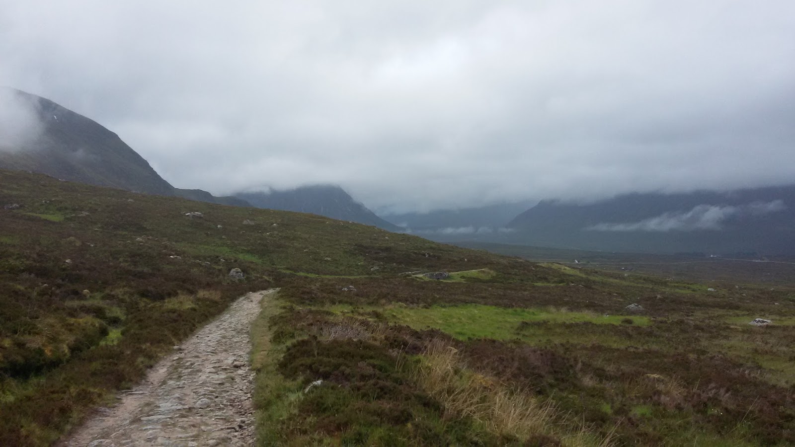
The worcestershire way is a small 31 miles trail in the middle of England. It cross farm fields and forest areas mixing steep muddy climbs with meadows and service paths. It starts at the town of  Bewdley by the river Severn and finish in Great Malvern after climb the northern Malvern hill, one of the highest points of the valley. 

Getting there- Birmingham is the main biggest city close by, from there a 45 minutes train to Kiddermister and after a 10 minutes bus to Bewdley. Note that this bus is not working on Sunday so it is a 3,5 miles walk. The way back from Great Malvern is much easy as it is well connected by train.

Signage and Navigation - The Worcestershire is well marked with a green pear sign but still a map or GPS is a must,  there is plenty of times that I had to track back to find the right way. I downloaded the GPS coordinates from the GPS walking routes. This route is actually 4 miles longer, keeping going south. The right GPS rout could be find in The Long Distance walker association but only members can download it.  In this website you can find some extra information about the trail.

Terrain : It is trail most of the time, be ready to cross muddy areas , specially in meadows, you will have to cross some farm areas with live stock but not much. Some dirty roads connecting trails.

Resupply and Logistics- In Bewdley, the starting point, there is supermarket and all kind of facilities. The only resupply places I saw in the trail was 2 pubs around mile 20 and 21 and a small post office with basic food around mile 26. So unless you want to make it until mile 20 the first night you will have to bring food for day and half. the pubs could be a good option for breakfast or lunch for the second day. The first pub and bed and breakfast is the The Admiral Rodney and the second is The Talbot. 


The Worcestershire Way


Water - there is plenty rivers around but I will prefer to get the water from some tap of the farms around. The rivers seems quite contaminated with agriculture products even using a mini sawyer.

Camping, logging : I normally do stealth camping and there is plenty of places where to hide and set your tent, not that this is not legal but I never had a problem specially because you are not in a national park where normally there is more control about it. Be ready for a lot of condensation, I went with Tarp tent, I would recommend a double fly. If you want to skip the tent those 2 pub offer also break and breakfast, so start early and do 20 miles until the first pub.

Gear : I went with my normal Gear, just be aware of the rain, and maybe bring extra socks , your shoes will get soak in the morning because of the dew drop. 


The worcestershire way


Saturday 5 March 2016

The west Highland Way, Scotland, Fort Willians


The west Highland way it has been a different experience. It is a mix between Pacific crest trail and camino de Santiago. You don’t have those 100 miles stretch; you pass ones a day by a small local pub. You have in the other hand those moments of solitude and wilderness of the PCT. You can stay in hostels or do like me and carry your shelter. I believe that in Scotland you can camp anywhere, you can cross private property...it is quite relax country with all this. Be aware of midges, small mosquitos, in summer time. I suffered quite a lot with this. You have water  kind of everywhere, it looks pristine but I always filter it, I just think in the all the sheep’s and pesticides, The last day you can climb the highest pick in the United Kingdom, Ben Nevis, over 1000m, a decided to skip it as it was a very foggy day and my knee need some rest to rest the GR20 in 3 days in Corsica!


Ben Nevis from google..


If you are thinking in do it the west highland way keep in mind the weather, rains a lot , I imagine like in the AT, here there is not much cover, there is not much trees and the floor seems like always wet, some days I found quite difficult to find a place to camp that is not soaked. All this rain and mist create a surreal atmosphere, full of mystery, legends. You can imagine why so many stories of monsters and witches   show up here. Walk in the mist in the forest around ruins of old houses and castles is something quite creepy. Regarding gear I recommend fully waterproof, I had trousers and jackets, pack cover and pack liner. I did it with a tarpent contrail and down sleeping bag 20 F Zpacks, I had stove, I like to wake up and have my coffee and do a hot dinner at night, during the day better do lunch in a pub.


Mist in Scotland ( google pic ) 


I found this trail crossing to much road or walking with the close noise of cars, you have some moments where you follow a trail in the middle of nowhere but you would come back to the road, it is a mix. The good thing is you always can have a good pint of local beer and taste the traditional dishes of Scotland. Scotland is very outdoors orientated; I think is a kind of Washington or Colorado where people likes the outdoors.

I would recommend hiking with a guide book, just to cover the basics, and an historic book. Here in Scotland there are so many stories about clan wars. It put you in the situation of the scenery in how the people used to leave in this difficult remote area.


I took back from fort Williams the scenic train (it is actually the normal train)  to Glasgow. If you have some more time in Scotland I will recommend going a little bit norths into the Isle of Skye, This is a beautiful place to hike, hiking heaven and you can reach it also by a scenic train. In Scotland there is a few more long trails. Reading about I saw the entry from the guy from Zpacks doing a coast to coast without trail, you suppose to find your way, using trails or cross-country, I found it very interesting, could be a good alternative. Before leaving Scotland pay a visit into the classic lake Ness Monster  ( loch Ness ) and spend time in Edinburgh, historic and vibrant city.


Isle of Skye , Scotland


Monday 22 February 2016

The west Highland Way, Lairigmor, Scotland

The west Highland Way,  Scotland

I was lucky, the morning brought some sun after a few days of rain , the first climb of the day is the called "Devils Staircase " a simple climb of 250 m, basically nothing, quite steep for a while but nothing, This is the highest point of the West Highland Way, so you can get the idea that the trail goes more into valleys than mountain crest. A little disappointed with that but is a beautiful trail.

Going down into the town of Kinlochleven I spot a hiking pole coming out from a bin, one was broken and the other was perfect, It was a black diamond ultra distance... a really good pole in carbon fiber. Last weekend was a race over here so someone must break one and just throw both....Like my extra hiking pole.
For this season I bought the Fizan 158 g poles, really happy with those. In this town I resupply a little and have some hot food and in the evening start the last part of the trail, finishing in Fort Williams.


The west Highland Way,  Scotland

There is some climb with views of the cost that put you into a Lairigmor Valley, with some old old stone houses, some sheep here and there, again more rain. It has been one of my favorite areas of the this trail and it is very accessible for anyone .Getting dark and trying to find somewhere to camp, nothing , walk more, found some possible camps but not perfect, no flat, to much water accumulation  It is one of those that you don't know if it is better to stop and camp or keep walking until find something better, finally it pay off, I found a flat dry area under some tree, thanks god , just what I need it. I am doing over 20 miles days without been in shape so I am struggling at the end of the days. The good news is that there is no midges here. the last days those midges had eaten me alive. Tomorrow last days.


The west Highland Way,  Scotland


The west Highland Way, Scotland , Rannoch Moors


The west Highland Way,  Scotland , Glen Coe entrance

I woke up with the sound of the rain, the rain is here and it would be until the end, weather forecast confirm, rain an more rain. The thing is that even raining it is not cold, is warm, so I still can go with shorts. I waited until 10.00 till rain stop to break camp, breakfast in Tyndrum and keep walking till Bridge of Orchy. I am getting frustrated with all this road noise walking so close to the road.....I though it would be more wild.


The west Highland Way,  Scotland , Rannoch Moors


In the afternoon this changed...First I got a rain shower , got soak and enter into the most inhabitant are of all United Kingdom. First you pass a beautiful lake with a cottage  where it was filmed one of the last movies of James Bond, the trail start to climb into the Rannoch Moor and here is where the sound of any cars disappear. This is the terrains most difficult to live. It is just undulation terrain with water all over. I did all this Moor raining but I really enjoy it, took many pictures. The path that I walk supposed to be built to move troops quickly in the area, are kind of military roads of the past.


The west Highland Way,  Scotland , Rannoch Moors


In the other side of the Valley you can see one of the most iconic valleys of Scotland, Glen Coe, I had the opportunity of drive by but not yet of hike it, this time I have not time. This area is quite special, you can think in all the history involve here and the different wars between the different clans and also the hardness and the beauty of this mountains.


I stop today at the entrance of Glen Coe, still raining. There is a pub just by where I got a drink and water. I decided to eat a sandwiches in the tent instead of cooking something because of the rain. Quite a few people in this camping site. Hopefully tomorrow I have some sun. It has been a long wet day but with a fantastic background. Tomorrow would be able to get very close to Ben Nevis and maybe climb it if there is a good weather forecast.