Showing posts with label hike. Show all posts

Saturday, 4 February 2017

GR 20, Corsica


GR20


The GR 20 is a  112 miles  "trail" in the island of Corsica, France, going through the roughed spine of the island. Often is said that is toughest  hike in Europe, in most of the part there is not trail ,you just follow the distinctive signs, jumping between granite rocks and climbing with the help of chains. You do not  need to be a climber ,  you would to be able to do basic scramble with your backpack. I would put below the typical questions that come to me during the planing stage.


How to reach the GR20 ?

Public transport is difficult if you arrive on Sunday to the airport, I did hitchhike to the trail. I was expecting a very difficult hitch from the airport but it was very quick, feel safe. Nice people.

North to south or south to north?

I did a trail before this one so I had my legs ready. I was anxious for how difficult would be the north part so I decided to do it first, was not that difficult. I really enjoy the technicality of the north part. Calenzana is also a  very nice small town where to start the adventure!

Most of the people start from the south to get used to the trail before reach the most challenging stage of the north.

How difficult is the trail?

Now I understand when people say  it is technical, it means is not just hike , you would have to scramble and move between rocks, you would  help yourself with chains. I did not feel my self in danger, maybe just ones or twice but anyone can do it. Some areas were difficult for me because I am scare of highs but don't need of any climbing experience.  The climbs are huge , you can gain 1000 metres in a few miles, very extenuates. 


During the 2650 miles of the pacific crest trail I can not remember any fall. During the 112 miles of the GR20 I fall twice and broke both hiking poles. I realize that after cross little springs the foot get wet and make them super slippery over the thin granite rocks !

How many miles do I hike a day?

In the north I was doing 1 mile an hour in some points, sometimes you need to cross a big fields of boulders without any trail, the climbs are very vertical and even going down make it quite slow because of the steep terrain. In the north I was following the stage and sleeping by the refuge, in the south you could do  easily a double stage, you could do 20 miles a day. I strongly suggest start early as at 12.00 could get really very hot, I paid this mistake big time and learned the lesson.

How I Navigate?

The route is well mark with red and white signs. If you are scrambling and you miss the signs for a few meters, careful! , probably you are out of the track, I saw a few people included myself having to retrack as we were out of the route. 

GR20 sign

Try to get as closer to the signs as possible, why? In front of the rock is death, behind is an easy pass......

I got a printed guide from cicerone that have some mini maps and also the information need it. I always carry the Backcountry navigation app in my phone with the corsica topo maps and track downloaded as back up. This app is not free, I think is just 7 £ but after you can download all the topo maps that you want. It is not the easiest app to use, I highly recommend it. 

Refuges or tent?

Myself a tent all the way, It is the main point for me to do the trail, the outdoors, I don't fancy sleep in a room with another 20 hikers, ( you have showers in the refuges ). In the north I was camping by the refuges, in the south I started doing one and half stages and do wild camping, it is a flatter terrain with more areas for camp. I brought a tart - tent, I was fine but in some of the areas were a little bit rocky. I cowboy camping a couple of times as the island hand a perfect weather , sunny and dry. Just got one storm.  Wild camping is illegal, so set the tent with the dust and break down early in the morning.

One of the most amazing sunset was  cowboy camping in the last stage  after pass the refuge di Paliri, The Changing colors of the red rocks are amazing in this valley and you will be the first person to reach the pools of Ruisseau de Punta Pinzuta in the morning , all for you.


How I resupply?

You can resupply ones a day in the refuges. The refuges have all. You can buy to cook yourself or you can eat like in a restaurant. Both are very pricey as food arrive by donkey or helicopter. I started with two and half days of food and try to resupply in the refuges that have road connection as food is much cheaper like : Haut Asco, Hotel Castel di vergio, Vizzavona or Bergeries de Capanelle. In the refuges in the mountains be ready to pay maybe triple the normal price of the food. You only be able to recharge your electronics in the refuges with road connection. I carried a 9000 aw battery pack.

I found quite difficult to get gas for stove , also when you arrive from the airport. I was lucky as one hiker finishing the trail gave a full canister.

I got water from the refuges, did not treat it and I carry the sawyer filter to get the water from streams. In top of the crest you will depend of snow patches. You will never be alone so you could ask any hiker for some water in an emergency.

Which gear did I carry ?

The Basic, think in good weather and maybe a summer storm, so minimal cloths: puffy jacket, flash water proof jacket for late in camp and your hiking clothes. I used the now old Tarpent cointrail as a shelter and 20 F. Really hike minimal in this trail but careful with sun protection and  did not get any mosquitoes !!! My default gear list is this link - Gear.

Gr 20, lac du Ninu


Do I recommend this trail?

Yes, big time, something different that the normal easy trail, enjoy a little bit of scramble, the views are astonished, the route is very good with nice weather,  You have many rivers and pools where to stop and swim, In some areas was worthy to inflate my termarest  and explore the pools. 

You also have those Bergeries where you can have a break and taste the local products like cured meats ans cheeses from shepherds. Bergeris are kind of  shepherds houses in the mountain.

After finish the trail I took a week to explore the beaches and the nice Mediterranean food from the island. I would don't mind to do this trail again , it is a lot of fun !

gr 20


Saturday, 5 March 2016

The west Highland Way, Scotland, Fort Willians


The west Highland way it has been a different experience. It is a mix between Pacific crest trail and camino de Santiago. You don’t have those 100 miles stretch; you pass ones a day by a small local pub. You have in the other hand those moments of solitude and wilderness of the PCT. You can stay in hostels or do like me and carry your shelter. I believe that in Scotland you can camp anywhere, you can cross private property...it is quite relax country with all this. Be aware of midges, small mosquitos, in summer time. I suffered quite a lot with this. You have water  kind of everywhere, it looks pristine but I always filter it, I just think in the all the sheep’s and pesticides, The last day you can climb the highest pick in the United Kingdom, Ben Nevis, over 1000m, a decided to skip it as it was a very foggy day and my knee need some rest to rest the GR20 in 3 days in Corsica!


Ben Nevis from google..


If you are thinking in do it the west highland way keep in mind the weather, rains a lot , I imagine like in the AT, here there is not much cover, there is not much trees and the floor seems like always wet, some days I found quite difficult to find a place to camp that is not soaked. All this rain and mist create a surreal atmosphere, full of mystery, legends. You can imagine why so many stories of monsters and witches   show up here. Walk in the mist in the forest around ruins of old houses and castles is something quite creepy. Regarding gear I recommend fully waterproof, I had trousers and jackets, pack cover and pack liner. I did it with a tarpent contrail and down sleeping bag 20 F Zpacks, I had stove, I like to wake up and have my coffee and do a hot dinner at night, during the day better do lunch in a pub.


Mist in Scotland ( google pic ) 


I found this trail crossing to much road or walking with the close noise of cars, you have some moments where you follow a trail in the middle of nowhere but you would come back to the road, it is a mix. The good thing is you always can have a good pint of local beer and taste the traditional dishes of Scotland. Scotland is very outdoors orientated; I think is a kind of Washington or Colorado where people likes the outdoors.

I would recommend hiking with a guide book, just to cover the basics, and an historic book. Here in Scotland there are so many stories about clan wars. It put you in the situation of the scenery in how the people used to leave in this difficult remote area.


I took back from fort Williams the scenic train (it is actually the normal train)  to Glasgow. If you have some more time in Scotland I will recommend going a little bit norths into the Isle of Skye, This is a beautiful place to hike, hiking heaven and you can reach it also by a scenic train. In Scotland there is a few more long trails. Reading about I saw the entry from the guy from Zpacks doing a coast to coast without trail, you suppose to find your way, using trails or cross-country, I found it very interesting, could be a good alternative. Before leaving Scotland pay a visit into the classic lake Ness Monster  ( loch Ness ) and spend time in Edinburgh, historic and vibrant city.


Isle of Skye , Scotland


Saturday, 20 June 2015

The west Highland way

 
After hike the PCT last year I knew that this year would be just something short as I will have just a month Holidays. After being in a quick visit in Scotland I discover the West Highland Way. Just 96 of not very rugged terrain but very beautiful and full  of history 


It is just 96 miles going from the outskirts of Glasgow up to Fort Williams. It is technically part of the Appalachian mountains.... I will try also to do an scape to Ben Nevis, highest point in the Uk, with just over 1000 m. Easy. I have just 5 days so I will have to keep the typical average of the PCT but without any training . I think should be ok as it is quite flat really , it like goes through valleys rather than by crests.


Regarding equipment is basically the same than PCT, ready for a few showers ....Tarp tent... I have a new watch Garmin so I am looking to see how it works and carrying and ebook as luxury. Anyway not much problem for food resupply with a maximum of 2 days from point to point , so easy and light.


Sunday, 1 February 2015

Burney Fall to Castella

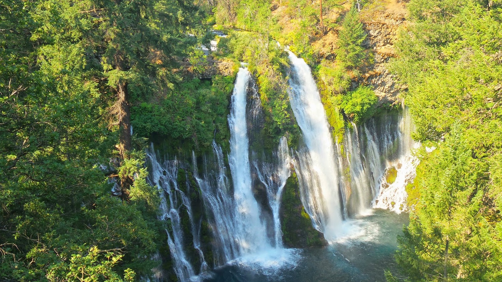
I reached the Burney state Park in the morning. I went to the shop to pick up my resupply box that I sent over here. As guides says , staff here is super unfriendly, super, super. No hello, no nothing. Super unfriendly and just thought F off !.On the way back to the trail I check out the fall, very pretty but my target of the day was Rock creek, a nice spot for lunch with different pools connected between them . Chill over there during the heat of the day and do the climb in the afternoon.


This Rock creek was fantastic , I did not went down to the big pools but just by the bridge I was able to cool down. Really hot. Have a nice lunch and relax the legs in the pools. I am finding that a the legs really appreciated a cold bath , I fell more relaxed and I sleep better. In the afternoon I camped by what here call a pound , a small water pool near a death end of a dirt road.

In this area there is water but It is quite difficult to find and is located in very weird places. One day I really mess up with the water. I try to go always with no more than a 1 Litre of water. I miss a creek and after I have to come back half mile after I did not take enough water as the afternoon was a big climb in the heat and without  tree cover. When you realize that you can start to be short of water is when you start to be more thirsty. Luckily I found a sign on the ground with the sign of H20 point down of the Valley, there you go, lose another hour just looking for water, I don't want to take risks in this area.


I saw up to 3 wild fires around me, big ones, but far enough from me to fell safe. North California and his auto - combustion problem. I camped by a dirt road in a ridge. I was having dinner at night and I could see now all the orange flames closer, wow. A little worry, I am a valley away from the fire.......Check the wind direction , I think I am ok for tonight.........


Wake up in the morning  and an easy descent into MC Cloud river, nice place but not the best place for a swim in the crossing point. I checked on the map a possible swimming spots 2 miles further, Take the risk but really pay off, maybe the best swimming spot of the PCT ( 300 m away) just whem the PCT turn right up to the mountains. I found this  little trail that was going down....Time for lunch put some air in the Theremarest and jump in to the water, love the PCT.  On my way back I found Blister, CJ and Blister sleeping Siesta, F hot it is, isn't it ?


I camped that evening with String Cheese,  we ere talking about why doing the PCT, etc....I quite enjoy. I couldnt find a really flat spot so I just sleep in the trail. The headlamp is playing games, it just turn off in the middle of the dinner, thanks I was not alone.......

The way down to Castella was very graded. At the beginning I thought it was a weird morning fog but after I realize, this is not fog , it is ash from the fires , all around. When I reached the road I met more hikers and gave the news, ok, many areas are shut down, fires are without control and more lighting is coming in the next days. People is getting rides, road walk and some people are trying to stay in the trail. I went to  Dismuir to resupply, check the news and take a decision for the next section, what to do?


I meet with Cracker Jack in the local Brewery, after last report we decide to walk road ( 100 miles ) no, just skip, we are still walking from Mexico to Canada....We got a super cheap hotel room in one of those nice  50 American hotels but without air -con. Worst night in the PCT, I thought a few times about hike out in the middle of the night.  We were set , Road walk starts tomorrow.